Hawaii Fish Replenishment Area boundaries in West Hawaii
It’s incredibly frustrating to head out for a day of fishing, excited to drop a line, only to realize you’ve stumbled into a specially regulated area you knew nothing about. West Hawaii, with its breathtaking Kona coastline, is a prime example of where ignorance of local fishing rules can lead to serious headaches. This guide is here to untangle the complexities of the Hawaii Fish Replenishment Area (FRA) boundaries in West Hawaii, ensuring you understand exactly where you can cast your line and what rules apply.
Understanding Fish Replenishment Areas (FRAs) in West Hawaii
Fish Replenishment Areas, or FRAs as they’re commonly known, are a crucial part of Hawaii's efforts to maintain healthy and sustainable fish populations, particularly for our cherished reef fish. Unlike Marine Life Conservation Districts (MLCDs) that often have very strict no-take policies, FRAs typically implement specific gear and species restrictions rather than outright bans on all fishing. This distinction is really important, because many anglers mistakenly believe FRAs are off-limits entirely, missing out on potential fishing opportunities, or worse, inadvertently breaking rules because they didn't understand the nuances.
The primary goal behind establishing FRAs, especially along the heavily fished Kona coast of the Big Island, is to allow certain fish species a chance to grow, reproduce, and ultimately "replenish" the surrounding fishing grounds. Think of them as dedicated nurseries or safe zones for fish, helping ensure that future generations of anglers, and the ocean ecosystem itself, can thrive. The Hawaii DLNR Division of Aquatic Resources (DAR) manages these areas, constantly reviewing and updating regulations based on scientific data and community input. Their foresight in establishing these zones years ago has been instrumental in protecting critical reef fish that are culturally and ecologically significant to Hawaii, like the vibrant uhu (parrotfish) and the highly prized moi (Pacific threadfin).
Specific Boundaries of West Hawaii FRAs
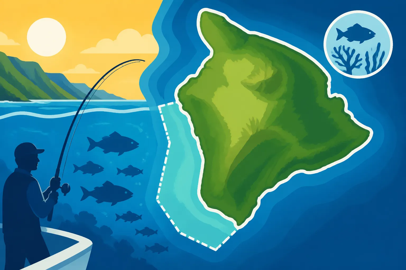
The West Hawaii Fish Replenishment Area (WHFRA) is a significant and well-defined zone stretching along the leeward coast of the Big Island, from the airport south to past Kealakekua Bay. Understanding these boundaries isn't just a recommendation; it's a necessity for responsible and legal fishing. The area covers a substantial stretch of coastline, and its landward and seaward markers are quite specific.
The entire West Hawai‘i Regional Fishery Management Area, which includes the FRAs, extends from Upolu Point in North Kohala to Ka Lae (South Point). Within this larger management area, the specific Fish Replenishment Areas are generally concentrated along the Kona coast. The boundaries are typically defined by shore-based landmarks and specific depth contours offshore.
For instance, a major section of the West Hawaii FRA begins roughly at Kailua-Kona, extending north and south. The landward boundary is the shoreline itself, which is pretty straightforward. However, the seaward boundary can get a bit tricky. It often follows a specific depth contour, like the 10-fathom (60-foot) depth curve or a designated line between prominent points. This means that while you might be able to fish closer to shore in some areas, venturing just a little further out could put you squarely within a regulated zone without obvious surface markers.
Let's break down some key segments of the West Hawaii FRA to give you a clearer picture:
- North Kona Segment: This area generally extends from a point near the Old Kona Airport State Recreation Area down to the Kailua Pier area. The complexities here often involve distinguishing between zones closer to shore and those extending into deeper water.
- Central Kona Segment: This is often the most heavily trafficked area for both recreational and charter fishing. It typically covers the waters around Kailua-Kona, extending south towards Keauhou Bay. For instance, the Honokohau Harbor area might have specific rules, while just outside the harbor, you could be in an FRA. Anglers often find navigating these waters challenging without a good marine chart or GPS.
- South Kona Segment: This section stretches south from Keauhou Bay, encompassing waters near Captain Cook and extending towards Kealakekua Bay. While Kealakekua Bay itself has extremely strict Kealakekua Bay Fishing Rules and Access as an MLCD, the areas immediately outside its boundaries and further south are often part of the FRA network.
Here's a simplified table illustrating key boundary characteristics, but remember, official DLNR charts are the definitive source:
| FRA Segment (General) | Landward Boundary (Mauka) | Seaward Boundary (Makai) | Key Distinguishing Features |
|---|---|---|---|
| North Kona | Natural Shoreline | Often 10-fathom contour | Near Old Airport to Kailua Pier |
| Central Kona | Natural Shoreline | Variable depth contour/points | Kailua-Kona to Keauhou Bay |
| South Kona | Natural Shoreline | Often 10-fathom contour | Keauhou Bay to Kealakekua Bay surroundings |
It’s truly a good idea to invest in up-to-date NOAA marine charts for the Kona coast. You can often find excellent, detailed charts, even waterproof versions, on sites like Amazon. These are invaluable for any serious angler, as they clearly depict depth contours and often denote regulated areas. Familiarizing yourself with these maps long before you hit the water will save you a lot of grief.
Fishing Regulations Within West Hawaii FRAs
Navigating the waters of West Hawaii means understanding that the Fish Replenishment Areas aren't necessarily "no-fishing" zones, but rather "regulated-fishing" zones. This distinction is where many anglers, particularly visitors, get confused. The rules within FRAs are designed to reduce fishing pressure on specific species and allow the ecosystem to recover, yet still permit some forms of sustainable fishing.
The most common types of restrictions you'll encounter within West Hawaii FRAs involve gear limitations and species-specific rules. For example:
- Spearfishing: This is a big one. While spearfishing is generally popular in Hawaii, FRAs often have very specific regulations, and sometimes outright bans, on certain types of spearfishing, particularly SCUBA spearfishing (which is already banned statewide in Hawaii) or the take of specific reef fish species with a spear. Always check the current Hawaii Spearfishing Regulations before heading out with a pole spear or Hawaiian sling.
- Net Fishing: Certain types of nets, especially those known to be unselective or harmful to reef structure, may be prohibited or heavily restricted. This is particularly true for gill nets or lay nets which can indiscriminately catch large numbers of fish. If you're considering using a net, understanding the Hawaii Net Fishing Restricted Areas is vital.
- Bag and Size Limits: While general statewide Hawaii Bag and Size Limits by Species exist, certain FRAs might have even more stringent limits for specific species, especially those identified as needing extra protection for replenishment. For example, popular reef fish like uhu (parrotfish) or moi (Pacific threadfin) often have special considerations. You’ll want to be intimately familiar with rules like the Hawaii Uhu Parrotfish Size and Bag Limits or the Hawaii Moi Closed Season, Explained if you plan to target them in an FRA.
- Fishing Methods: Traditional rod and reel fishing, handline fishing, and throw net fishing for baitfish are often still permitted, but again, always verify the specifics for the particular FRA you plan to visit. The intent is to encourage more selective fishing practices.
It’s imperative to remember that these regulations are actively enforced by the Hawaii Department of Land and Natural Resources (DLNR) Division of Conservation and Resources Enforcement (DOCARE). Violations can lead to significant penalties, including hefty fines and the confiscation of your gear. Trust me, nobody wants their prized fishing rod, maybe one you even picked up from Amazon with all the bells and whistles, to end up in an evidence locker because of an oversight! This is why understanding Fishing Without a Required License in Hawaii: Penalties and other regulations is so critical.
The best practice is to always consult the official Hawaii DLNR Division of Aquatic Resources (DAR) website or obtain their latest regulation pamphlets. They are the ultimate authority and source for all current rules.
Navigating and Identifying FRA Zones While Fishing
Knowing where the Fish Replenishment Areas are and what rules apply is one thing; actually staying compliant while you're out on the water, especially in unfamiliar territory, is another challenge entirely. The West Hawaii coastline, while beautiful, doesn't come with giant underwater signs marking FRA boundaries. So, how do you reliably navigate these zones?
-
Utilize GPS Technology: This is arguably your most powerful tool.
- Marine Chartplotters: If you're on a boat, a dedicated marine chartplotter with up-to-date electronic charts is a game-changer. These devices often overlay regulated areas directly onto your navigation screen, providing real-time alerts if you approach or enter a restricted zone. Brands like Garmin, Lowrance, and Simrad offer excellent chartplotters.
- Smartphone Apps: For smaller boats, kayaks, or even shore fishing, many marine navigation apps for smartphones and tablets can display NOAA charts and allow you to mark custom waypoints for FRA boundaries. Just be sure to download charts for offline use, as cell service can be spotty in some coastal areas.
- Personal GPS Units: Handheld GPS units, commonly used for hiking or hunting, can also be programmed with coordinates for FRA boundaries. You can get a reliable one from Amazon.
-
Consult Official Marine Charts: Even with electronic navigation, having a paper copy of a marine chart is a smart backup. These charts clearly depict depth contours, navigational aids, and often the boundaries of regulated areas. Study them at home, highlight the FRAs, and keep them on board (preferably a waterproof version) for quick reference.
-
Learn Key Landmarks: Many FRA boundaries are defined by specific shoreline features or ranges (lining up two points on land). Before you head out, identify these visual cues on your map and try to spot them from the water. For instance, a boundary might run from the tip of one lava flow to a prominent coconut tree stand on another point.
-
Reference DLNR Resources:
- The Hawaii DLNR Division of Aquatic Resources (DAR) website is your absolute best friend. They often have detailed maps, coordinates, and downloadable PDFs of the regulations. Make it a habit to check their site before every trip. This is crucial for staying current, as regulations can sometimes be adjusted. A thorough read of the official Hawaii DLNR Fishing Regulations Explained can clarify many ambiguities.
- Don't be shy about contacting DAR directly if you have specific questions about a particular area. Their staff are there to help anglers understand and comply with the rules.
-
Talk to Locals: While local knowledge should always be cross-referenced with official sources, seasoned local anglers can offer invaluable insights into how these boundaries are perceived and fished. They often know the subtle visual cues or common interpretations that might not be immediately obvious from a map. When you visit a local tackle shop to pick up some gear or bait, perhaps even some specific lures you saw recommended on Amazon, strike up a conversation. Just remember that friendly advice is not a substitute for official rules.
By combining these methods, you'll be well-equipped to enjoy the incredible fishing opportunities of West Hawaii while also being a responsible steward of its precious marine resources. Staying informed is the best way to avoid accidental violations and contribute to the long-term health of our oceans. Don't forget, a quick read of guides like Reading the Hawaii DLNR Fishing Regulations can make a huge difference in your understanding.
Disclaimer
The information provided in this guide is for general informational purposes only and is subject to change. While we strive to provide accurate and up-to-date details, fishing regulations in Hawaii, including specific boundaries and rules for Fish Replenishment Areas, are constantly reviewed and updated by the Hawaii Department of Land and Natural Resources (DLNR). It is the sole responsibility of each angler to consult the official Hawaii DLNR Division of Aquatic Resources (DAR) website or local offices for the most current and precise regulations before engaging in any fishing activity. Failure to do so may result in penalties.